Understanding Ground Penetrating Radar Technology
Ground Penetrating Radar (GPR) has revolutionised the field of surveying, providing essential data for construction projects, infrastructure maintenance, and environmental assessments. By utilising high-frequency radar pulses, GPR systems can effectively penetrate the ground, enabling surveyors to detect and map underground utilities, geological features, and archaeological sites. The technology’s non-invasive nature ensures minimal disruption to the surrounding area, making it an invaluable tool for both urban and rural projects. When exploring options, GPR Utility surveys London can provide comprehensive insights into the underground landscape, enhancing project planning and execution.
What is GPR and How Does it Work?
Ground Penetrating Radar is a geophysical method that employs radar pulses to image the subsurface. The radar system transmits short bursts of electromagnetic energy into the ground, which then reflects off various subsurface materials. These reflections are captured by a receiver, and the data is processed to generate images of the subsurface features.
GPR systems consist of a transmitter, which sends out the radar pulses, and a receiver, which detects the reflected signals. The time it takes for the radar waves to return to the receiver provides information about the depth and composition of the materials they pass through. This method can identify pipes, cables, voids, and even different soil strata.
Applications of GPR in Utility Surveys
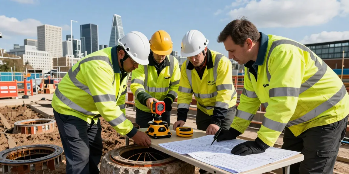
GPR is widely used in utility surveys to locate and map underground utilities such as water, sewage, and gas lines, along with electrical cables. Its ability to provide real-time data allows for rapid decision-making during construction projects, thereby reducing the risk of damaging existing infrastructure and improving overall project safety.
- Mapping the locations of underground utilities
- Detecting voids or cavities that may pose structural risks
- Assessing the condition of buried infrastructure
- Planning for new construction and excavation
Benefits of GPR Utility Surveys for Local Projects
Conducting GPR utility surveys offers numerous benefits for local projects. Firstly, the non-destructive nature of GPR means that it can be used without causing damage to existing utilities, making it a safe option for urban areas where complex networks of pipes and cables coexist. Furthermore, GPR surveys can significantly reduce the costs associated with excavation and repair, as they provide clear insights into the subsurface conditions.
Additionally, GPR surveys improve the accuracy of project planning and execution. By utilising detailed subsurface data, project managers can devise comprehensive strategies that minimise delays and unforeseen complications during construction.
Key Considerations for GPR Utility Surveys London
Choosing the Right Surveying Company
Selecting a qualified and experienced surveying company is crucial for the success of any GPR utility survey. It is essential to consider factors such as the company’s accreditation, the experience of their surveyors, and the technology they use. A reputable firm will not only provide accurate data but also ensure compliance with industry standards such as PAS 128, which governs the location and mapping of underground utilities.
Preparing Your Site for GPR Surveys
Site preparation plays a vital role in the effectiveness of GPR surveys. Ensuring that the survey area is accessible and cleared of obstructions will facilitate a smoother surveying process. This may involve coordinating with local authorities and utility companies to mark existing service lines and ensure that all safety protocols are in place.
Common Challenges and Solutions
One of the main challenges in conducting GPR surveys is the presence of interfering materials that can distort the radar signals, such as rebar in concrete or water-saturated soils. Understanding the limitations of GPR technology and employing additional survey techniques, such as electromagnetic induction, can help overcome these challenges and enhance data clarity.
Furthermore, the interpretation of GPR data requires experience and expertise. Working with skilled professionals who can accurately analyse the results and provide actionable insights is essential for making informed decisions regarding construction and utility management.
Best Practices for GPR Utility Surveys
Conducting Effective GPR Surveys
To conduct effective GPR utility surveys, it is essential to utilise high-quality equipment and adhere to best practices in data collection. This includes ensuring that the radar system is calibrated correctly and that survey parameters, such as antenna frequency and survey speed, are optimised for the specific site conditions.
Regular maintenance of the GPR equipment and ongoing training for operators can significantly enhance the accuracy and reliability of survey results.
Interpreting Survey Data Accurately
Interpreting GPR data requires a deep understanding of how radar waves interact with different materials. Accuracy in interpretation can be improved by cross-referencing GPR results with existing utility maps and conducting supplementary surveys using other technologies.
Visualisation software can also aid in presenting the data clearly, allowing stakeholders to understand the implications of the findings for their projects.
Utilising Results for Construction Planning
The results from GPR surveys provide valuable insights that should be integrated into construction planning processes. Building information models (BIM) can be updated with GPR findings to create a comprehensive overview of the site, highlighting potential risks and utility placements. This proactive approach can mitigate issues during the construction phase, ultimately leading to reduced costs and time savings.
Future Trends in GPR Utility Surveys
Technological Advancements Expected by 2026
As technology continues to evolve, the methods and tools used in GPR utility surveys are expected to become increasingly sophisticated. Advancements may include higher resolution imaging, improved data processing algorithms, and enhanced integration with other surveying technologies such as drones and 3D laser scanning.
These innovations are likely to improve the accuracy of surveys and expand the range of applications for GPR in various sectors, including environmental assessments and archaeological investigations.
Shifts in Industry Standards and Regulations
With the increasing reliance on GPR for utility mapping, regulations governing its use are also evolving. New standards may emerge to ensure that surveys meet the necessary quality and safety benchmarks, enhancing the reliability of the data collected. Staying abreast of these changes will be essential for surveying companies to ensure compliance and maintain competitive advantage.
Integrating GPR with Other Survey Techniques
The future of GPR utility surveys lies in the integration of multiple surveying techniques. Combining GPR with traditional surveying methods and advanced technologies can enhance the overall quality and accuracy of data collected. This multifaceted approach not only improves project outcomes but also provides a more comprehensive picture of the subsurface landscape.
Case Studies: Successful GPR Utility Surveys in London
Urban Development Projects and GPR Insights
Numerous urban development projects in London have successfully utilised GPR utility surveys to navigate the complex network of underground utilities. For example, during the expansion of a major subway line, GPR was employed to map existing utilities, preventing costly damages and delays. The insights gained allowed for the meticulous planning of the construction phases, ensuring a smooth workflow.
Challenges Overcome: Real Examples
In another instance, a commercial development faced significant challenges due to previously unidentified utilities. Through the use of GPR, the team was able to located these utilities early in the project, enabling timely modifications to the design that saved both time and money.
Impact on Project Timelines and Costs
By leveraging GPR technology, project teams can drastically reduce the unforeseen challenges that often lead to project overruns. Efficient utility mapping allows for better scheduling of construction activities, ultimately resulting in projects being completed on time and within budget.
What are GPR Utility surveys?
GPR Utility surveys are non-invasive assessments that use radar technology to locate and map underground utilities. This method is critical for construction projects to avoid damaging existing infrastructures, ensuring safer and more efficient planning.
How does GPR improve surveying accuracy?
By providing real-time data and high-resolution images of subsurface conditions, GPR significantly enhances the accuracy of utility surveys. This facilitates better decision-making in construction and maintenance planning.
What should I expect during a GPR survey?
During a GPR survey, you can expect specialists using advanced radar equipment to scan the designated area. They will collect data that will be processed and interpreted to provide comprehensive maps of underground utilities.
Can GPR surveys identify all types of utilities?
While GPR is highly effective in locating various types of utilities, its performance can vary based on factors like the material composition and condition of the utilities. For best results, GPR is often used in conjunction with other detection methods.
How do I choose a reliable GPR surveying company?
To choose a reliable GPR surveying company, consider their experience, industry certifications, and customer reviews. A reputable company should also be transparent about their methodologies and provide sample reports from previous projects.